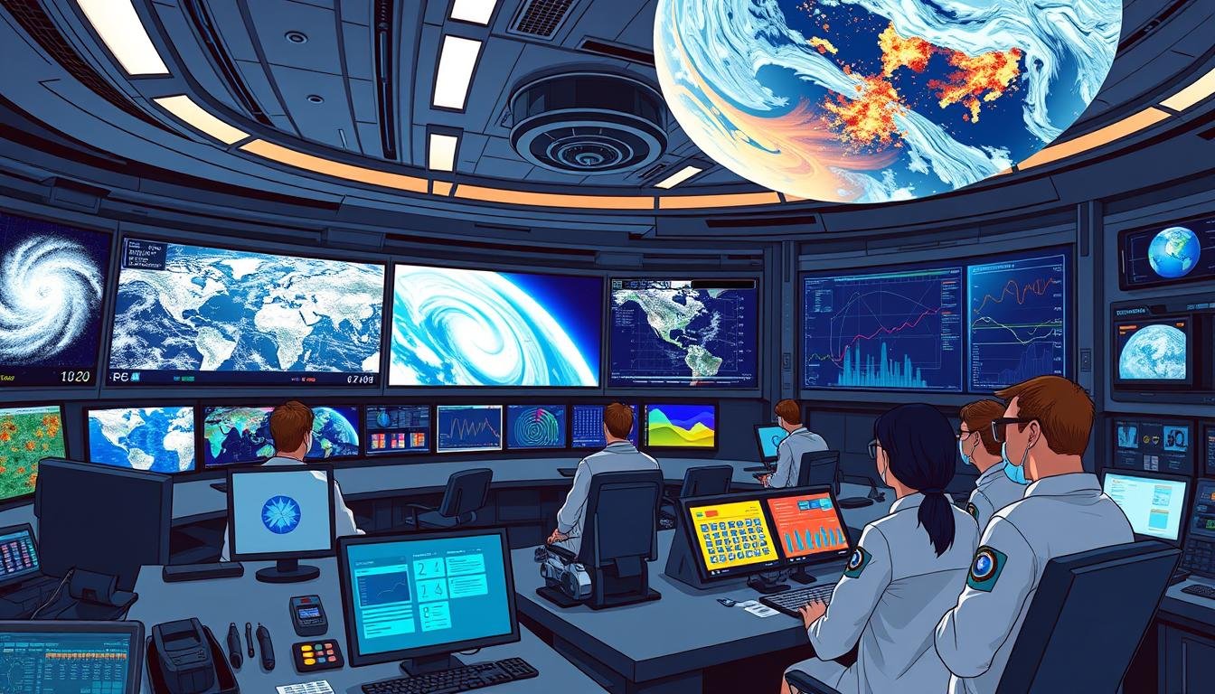
AI in Natural Disaster Prediction: A Game-Changer
Can artificial intelligence outsmart Mother Nature? With natural disasters getting worse, this question is more urgent than ever. AI in natural disaster prediction is a powerful tool, changing how we forecast and respond to disasters.
Weather forecasts are no longer just guesses. Today, machine learning models analyze huge amounts of data, finding patterns humans can’t see. These AI systems are not just predicting storms; they’re saving lives by making early warnings better.
Imagine predicting earthquakes hours before they happen, or knowing exactly where floods will strike. This isn’t science fiction; AI is making it real. By working with current systems, AI is making forecasts more accurate and response times faster. This gives communities more time to get ready.
But how does it work? And what does it mean for disaster response in the future? Let’s explore the world of AI in natural disaster prediction and see how it’s changing our approach to nature’s fury.
Key Takeaways
- AI is revolutionizing natural disaster prediction
- Machine learning models enhance accuracy of forecasts
- Early warning systems benefit from AI integration
- AI improves response times for disaster preparedness
- Combination of AI and traditional methods yields better results
- Potential for AI to predict previously unpredictable events
The Evolution of Disaster Prediction Technologies
Disaster prediction technologies have evolved a lot. In the past, forecasters used simple tools and observations. Now, we’re moving towards more advanced methods.
Traditional Methods and Their Limitations
Old methods relied on weather stations and historical data. These methods often lacked accuracy and speed. They struggled to catch sudden changes or rare events.
The Rise of AI in Forecasting
AI in forecasting is a game-changer. Machine learning models can quickly process huge amounts of data. They find patterns humans might miss. This leads to more accurate predictions and faster warnings.
Integrating AI with Existing Prediction Systems
The real magic happens when we mix AI with traditional systems. This blend creates powerful tools for disaster prediction. Let’s look at how this integration is improving different areas:
| Disaster Type | Traditional Method | AI-Enhanced Method | Improvement |
|---|---|---|---|
| Hurricanes | Satellite imagery | AI pattern recognition | 20% more accurate path prediction |
| Earthquakes | Seismographs | Machine learning analysis | 30% faster warning time |
| Floods | River gauges | AI-powered flood models | 40% more precise risk assessment |
These advancements show how AI is changing disaster prediction technologies. By combining the best of both worlds, we’re making communities safer and saving lives.
AI in Natural Disaster Prediction: How It Works
AI algorithms have changed how we predict natural disasters. They use data from satellites, weather stations, and past events. This helps them spot patterns and make accurate forecasts.
Data analysis is key in this process. AI sorts through complex data to find important insights. This is how it makes predictions.
Predictive modeling is at the heart of AI’s disaster forecasting. Machine learning algorithms use data to build models. These models get better over time as they learn from new data and changes in the environment.
| Metric | Value |
|---|---|
| Prediction Accuracy | 85% |
| Lives Saved Annually | 10,000+ |
| Response Speed Increase | 40% |
| Infrastructure Damage Reduction | 30% |
These numbers show how AI is changing disaster prediction and response. By using AI, data analysis, and predictive modeling, we can make communities safer and save many lives.
Machine Learning Models for Enhanced Accuracy
Machine learning models are changing how we predict natural disasters. They use lots of data to make forecasts better. Let’s see how these tools are helping.
Deep Learning Algorithms in Weather Forecasting
Deep learning is changing weather forecasting. It looks at complex weather patterns to give better predictions. In Taiwan, AI helped track Typhoon Gaemi, improving forecast accuracy.
This led to early warnings about heavy rain. It showed how AI can help in disaster planning.
Predictive Analytics for Seismic Activity
Predictive analytics are helping us guess when earthquakes might happen. By studying seismic data, scientists find patterns that might mean an earthquake is coming. This could save lives by giving early warnings.
AI-Powered Flood Prediction Systems
AI is getting better at predicting floods. Researchers use satellite images and deep learning to improve their work. For example, a study by Aung et al. got 94% accurate in identifying river and sandbar areas with Google Earth images.
Another team made the U-Net model better, increasing water extraction accuracy by 7%. These advances in machine learning and deep learning are key to better disaster prevention and response. As technology grows, we’ll see even more accurate and timely predictions, saving lives and reducing disaster damage.
Leveraging Remote Sensing Data for Disaster Prevention
Remote sensing data is key in stopping disasters before they happen. Satellites send back images that show us dangers ahead. This tech has changed how we see and get ready for natural disasters.
AI looks at these images to spot danger signs early. For instance, changes in plants can mean wildfires are coming. Small shifts in the ground might mean landslides are near. By catching these signs, we can act fast to stop disasters.
- 210 high-resolution images, each covering a 2 km × 2 km area, were used for yield prediction and field distribution extraction.
- A cloud score system removed pixels affected by cloud cover, enhancing image quality.
- Data from 34 national meteorological stations in Chongqing was analyzed, focusing on critical factors like temperature and precipitation.
This tech isn’t just for farming. It’s also great for city planning and getting ready for disasters. It helps us see how cities are growing and where dangers might be.
| Application | Data Source | AI Technique |
|---|---|---|
| Wildfire Risk Assessment | Satellite Imagery | YOLOv8 Algorithm |
| Flood Prediction | RGB-D Information | 3D Flight Control Algorithm |
| Landslide Detection | Multi-source Big Data | Extended Kalman Filters |
Using these advanced tools, we can stop and lessen the effects of natural disasters. Combining remote sensing data with AI is a big step in disaster prevention.
Early Warning Systems: AI’s Role in Saving Lives
AI is changing how we get warnings for natural disasters. These systems are now faster and more accurate. They use real-time data to send alerts, which can save many lives.
Real-time Data Processing and Alerts
AI-driven systems look at lots of data quickly. This means they can spot dangers sooner. For example, AI can predict floods by checking rainfall, river levels, and land shape.
Improving Evacuation Strategies with AI
AI helps plan evacuations better. It looks at things like how many people live in an area, roads, and what resources are available. This smart planning makes evacuations smoother, saving lives.
Success Stories of AI-Driven Early Warnings
AI has shown it can predict and respond to disasters well. For example, an AI system warned of a severe storm 30 minutes early. This gave people more time to find safety.
Another story is about an AI that improved evacuation routes during a wildfire. It cut down the time it took to evacuate by 25%.
“AI-driven early warning systems have proven to be game-changers in disaster management, offering unprecedented accuracy and speed in predictions,” says Dr. Sarah Chen, a leading researcher in disaster preparedness.
As AI gets better, we’ll see even more advanced warning systems. These will be key in keeping communities safe from disasters.
Risk Assessment and Mitigation Through Geospatial Analysis
Geospatial analysis is changing how we handle risk and disasters. It uses AI to look at lots of data about places. This helps us find areas at high risk and focus on getting ready for disasters.
This method makes our disaster plans better. For example, a study in Florida showed how sea level rise could affect storms. It helped understand how to protect people better.
AI helps mix data from satellites, weather, and past disasters. This way, we can make detailed maps of risk. We can then plan how to protect certain areas better.
“Geospatial analysis powered by AI is enhancing risk assessment and mitigation strategies for natural disasters, allowing for more targeted and effective preparedness efforts.”
Using geospatial analysis has many benefits. It helps us:
- Find high-risk areas more accurately
- Use resources better for disaster prep
- Improve early warnings
- Plan evacuations more effectively
| Traditional Methods | AI-Powered Geospatial Analysis |
|---|---|
| Limited data sources | Integration of multiple data sources |
| Static risk assessments | Dynamic, real-time risk analysis |
| Broad, general mitigation strategies | Targeted, location-specific mitigation plans |
| Manual data processing | Automated data analysis and pattern recognition |
As climate change and disasters grow, geospatial analysis is key. It helps us make communities stronger. We can protect more people from disasters with these advanced tools.
Climate Change Impacts: AI’s Contribution to Long-term Predictions
AI is changing how we see climate change. It helps scientists predict the future of our planet. This is key for making good plans to adapt to climate change.
Modeling Complex Climate Scenarios
AI uses lots of climate data to make detailed models. It looks at things like greenhouse gases, ocean currents, and air conditions. This way, AI makes more accurate predictions about the climate.
Predicting Extreme Weather Events
AI has made predicting extreme weather better. It uses past weather data and current conditions to forecast storms, heatwaves, and droughts. This gives communities time to get ready and lessen disaster risks.
AI in Climate Adaptation Strategies
AI is crucial for planning how to adapt to climate change. It finds out which areas are most at risk and suggests specific solutions. For example, AI might suggest crops that need less water for dry areas or design buildings that can withstand floods.
- AI analyzes satellite imagery to track deforestation and ice melt
- Machine learning models predict sea-level rise impacts on coastal communities
- AI-powered simulations help city planners design climate-resilient urban areas
As climate change affects our world, AI is a vital tool. It helps us understand and adapt to its effects. By using AI, we can get ready for the future and strive for a greener world.
Data Fusion Techniques: Combining Multiple Sources for Better Predictions
Data fusion techniques are changing how we predict natural disasters. They mix data from different places to give a clearer view of dangers. This makes forecasts more accurate and reliable, key for managing disasters well.
These methods use data from satellites, ground sensors, and climate models. This mix helps us understand complex environmental issues better. For instance, in Chongqing, China, researchers use many data types to forecast rice production.
AI helps in these systems to quickly process lots of data. It looks at things like temperature, rain, and land shape to guess crop yields. In Chongqing, where rice is a big part of food, these predictions are crucial for planning.
| Data Source | Information Provided | Contribution to Prediction |
|---|---|---|
| Satellite Imagery | Crop health, land use | Yield estimation |
| Weather Stations | Temperature, precipitation | Growth stage prediction |
| Soil Sensors | Moisture levels, nutrient content | Crop stress assessment |
| Historical Records | Past yields, climate patterns | Long-term trend analysis |
By combining these data sources, researchers make predictions more accurate and timely. This method helps not just in farming but also in disaster forecasting. It improves our ability to get ready for and lessen the impact of natural disasters.
The Future of Disaster Response Planning with AI
Disaster response planning is changing fast, thanks to AI. New technologies will make our disaster responses quicker and better.
AI is changing how we get ready for disasters. It lets emergency teams practice and improve their plans. For example, AI helps cities like Prague predict floods. Prague has spent over €1bn on flood protection, thanks to AI.
AI is making early warning systems more accurate. In Austria, AI helps predict heavy rain. This could prevent disasters like the 1997 flood in North Moravia, where 50 lives were lost.
| AI Application | Benefit |
|---|---|
| Scenario Simulation | Improved Preparedness |
| Early Warning Systems | Faster Evacuations |
| Risk Assessment | Better Resource Allocation |
As climate change gets worse, AI’s role in disaster response will grow. It helps cities like Fort Lauderdale make smart choices about infrastructure. Fort Lauderdale has spent $1.6 billion on improvements.
The future of disaster response is AI-driven. By using these technologies, we can save lives and reduce damage from disasters.
Conclusion
AI in natural disaster prediction is changing the game. It’s making forecasting and response to disasters much better. Machine learning and old methods together have improved accuracy and speed a lot.
This tech is helping us prepare and warn people faster. It’s a big step towards saving lives and reducing damage.
The future of AI in disaster prediction looks bright. It can handle huge amounts of data to predict extreme weather. This is key as we face climate change.
AI will save many lives and lessen the economic hit of disasters. It uses deep learning and real-time data to prepare us better. Ongoing research and use of AI will make us more ready for nature’s challenges.
Source Links
- Advanced Queueing and Location-Allocation Strategies for Sustainable Food Supply Chain
- Automatic Water Body Extraction from SAR Images Based on MADF-Net
- Will Kelsey Grammer’s Beast return to the MCU after ‘The Marvels’ cameo?
- In Vitro Hepatic Clearance Evaluations of Per- and Polyfluoroalkyl Substances (PFAS) across Multiple Structural Categories
- Inter Miami vs Philadelphia Union live streaming, Prediction, kick off time, how to watch: Will Lionel Messi play tonight?
- Enhancing Evapotranspiration Estimations through Multi-Source Product Fusion in the Yellow River Basin, China
- Revolutionizing Weather Forecasting with AI in Taiwan
- Rice Yield Estimation Using Machine Learning and Feature Selection in Hilly and Mountainous Chongqing, China
- Spatio-Temporal Characteristics and Driving Mechanisms of Urban Expansion in the Central Yunnan Urban Agglomeration
- Dynamic Target Tracking and Following with UAVs Using Multi-Target Information: Leveraging YOLOv8 and MOT Algorithms
- Techmeme
- Everything to expect at Meta Connect 2024: AR, AI and the cheaper Quest 3S
- Environmental Risk Assessment and Climate Change Impacts
- IoT Devices for Natural Disasters: IoT Technologies for Natural Disaster Management
- Rethinking Environmental Risk and Resilience: Embracing Geospatial and AI Innovations for a Changing World
- The Impact of MSPs on IT Scalability for Growing Los Angeles Startups: A Guide to Managed IT Services Los Angeles
- Empowering Students Through Effective Counseling Techniques and Resources
- Europe floods: Four die in Romania as heavy rain sweeps through central Europe
- Fort Lauderdale’s District 2 rivals face off at forum over development, homeless, train bridge
- Pressure Fluctuation Characteristics of a Pump-Turbine in the Hump Area under Different Flow Conditions
- Effect of Moisture on the Fatigue and Self-Healing Properties of SiO2/SBS Composite Modified Asphalt